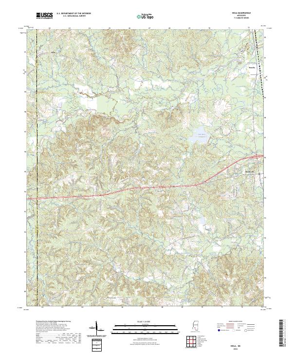
2024 Map of Nola
USGS Topo · Published 2024About this map
Fair River meanders across this portion of Lawrence County, Mississippi, carving a winding path through a landscape defined by its complex network of creeks and tributaries. The settlement of Monticello anchors the eastern edge of the map, while smaller communities like Nola and Rosella mark the northern reaches. This modern survey illustrates the persistent rural character of the region, where family names are etched into the local geography through thoroughfares such as Sontag Nola Rd, George Bennet Rd, and Henry Smith Rd. Significant water features like Lake Mary Crawford and the Joseph Neylans Spring highlight the abundance of freshwater resources that have long influenced settlement patterns here. The map also records the boundary line between Lincoln County and Lawrence County, showing how these political divisions intersect with the natural drainage basins of Bear Creek and Marshall Creek.
Find a feature on this map
82 named features on this map. Tap any name to fly to it.
Don’t see what you’re looking for? This feature index may not catch every label — zoom into the map to look around manually.
Map Details
Editions of this 2024 Nola Map
This is the sole edition of this map. No revisions or reprints were ever made.
Other maps of this area

1953 · Natchez
USGS Topo · 1:250,000

1956 · Natchez
USGS Topo · 1:250,000

1959 · Natchez
USGS Topo · 1:250,000

1970 · Topeka
USGS Topo · 1:24,000

1970 · Monticello
USGS Topo · 1:24,000

1970 · Nola
USGS Topo · 1:24,000
1970 · Tilton
USGS Topo · 1:24,000
1971 · Monticello NE
USGS Topo · 1:24,000

1971 · Oma
USGS Topo · 1:24,000

1972 · Fair Oak Springs
USGS Topo · 1:24,000