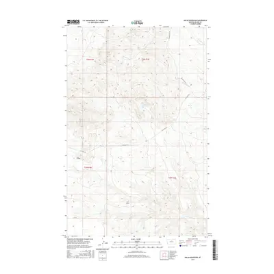
2017 Map of Nolan Reservoir
USGS Topo · Published 2017About this map
Nolan Reservoir sits at the center of this high-plains landscape in Blaine County, capturing the seasonal runoff of a drainage network that includes Christenson Br. The map illustrates a remote ranching and grazing territory defined by significant topographic landmarks like Lion Butte and the winding paths of Coal Mine Coulee and Lion Coulee. Human transit through this portion of the Montana prairie is marked by the historical path of the Cow Island Trl, which traverses the terrain alongside local routes like Lloyd Rd and Golden Valley Rd. The presence of Bear Paw Springs and the N Fork Lion Coulee further highlights the critical importance of water sources in this dry, open environment during the early 21st century.
Find a feature on this map
14 named features on this map. Tap any name to fly to it.
Don’t see what you’re looking for? This feature index may not catch every label — zoom into the map to look around manually.
Map Details
Editions of this 2017 Nolan Reservoir Map
This is the sole edition of this map. No revisions or reprints were ever made.
Other maps of this area

1953 · Havre
USGS Topo · 1:250,000
1954 · Bird Rapids
USGS Topo · 1:24,000
1954 · Leroy
USGS Topo · 1:24,000

1954 · Lewistown
USGS Topo · 1:250,000
1956 · Maddux
USGS Topo · 1:62,500
1956 · Rattlesnake
USGS Topo · 1:62,500

1957 · Havre
USGS Topo · 1:250,000

1958 · Havre
USGS Topo · 1:250,000

1959 · Lewistown
USGS Topo · 1:250,000
1964 · Ragland Bench
USGS Topo · 1:24,000