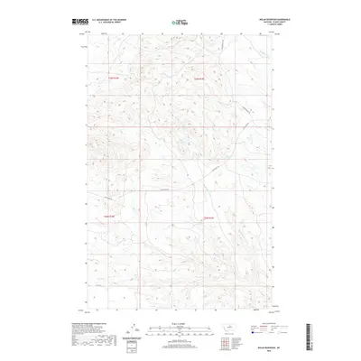
2020 Map of Nolan Reservoir
USGS Topo · Published 2020About this map
Nolan Reservoir sits at the center of this Blaine County landscape, where the drainages of the N Fork Linn Coulee and Christenson Br carve through the high plains. This 2020 survey illustrates a region defined by sparse water sources and historic transit routes, most notably the path of the Cow Island Trl crossing the southern and central sections of the quadrangle. The naming conventions, such as Coal Mine Coulee in the northeast, reflect the local geography's historical utility. This terrain is marked by essential water points like Bear Paw Springs, which served as vital landmarks for early travelers and ranching operations. Modern access is maintained via Golden Valley Rd and Lloyd Rd, connecting these isolated water features to the broader county road network.
Find a feature on this map
12 named features on this map. Tap any name to fly to it.
Don’t see what you’re looking for? This feature index may not catch every label — zoom into the map to look around manually.
Map Details
Editions of this 2020 Nolan Reservoir Map
This is the sole edition of this map. No revisions or reprints were ever made.
Other maps of this area

1953 · Havre
USGS Topo · 1:250,000

1954 · Bird Rapids
USGS Topo · 1:24,000

1954 · Leroy
USGS Topo · 1:24,000

1954 · Lewistown
USGS Topo · 1:250,000

1956 · Maddux
USGS Topo · 1:62,500

1956 · Rattlesnake
USGS Topo · 1:62,500

1957 · Havre
USGS Topo · 1:250,000

1958 · Havre
USGS Topo · 1:250,000

1959 · Lewistown
USGS Topo · 1:250,000

1964 · Ragland Bench
USGS Topo · 1:24,000