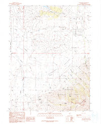
1990 Map of Noon Rock
USGS Topo · Published 1991About this map
Pleasant Valley unfolds along the western slopes of the Ruby Mountains, where small settlements like Brennen and Peterson sit between the mountains and the South Fork Indian Reservation. The landscape is defined by its complex irrigation and drainage network, featuring an extensive Aqueduct and numerous Ditch segments that channel mountain runoff from the Humboldt National Forest to agricultural use. Named features like Dry Farm Reservoir and several Water Tank installations highlight the critical management of water in this high-elevation terrain.
Find a feature on this map
46 named features on this map. Tap any name to fly to it.
Don’t see what you’re looking for? This feature index may not catch every label — zoom into the map to look around manually.
Map Details
Editions of this 1990 Noon Rock Map
This is the sole edition of this map. No revisions or reprints were ever made.
Other maps of this area

1935 · Halleck
USGS Topo · 1:125,000

1955 · Elko
USGS Topo · 1:250,000

1957 · Elko East
USGS Topo · 1:24,000

1958 · Elko
USGS Topo · 1:250,000

1962 · Elko
USGS Topo · 1:250,000

1962 · Boyd Reservoir
USGS Topo · 1:24,000
1962 · Elko East
USGS Topo · 1:24,000

1962 · Lee
USGS Topo · 1:62,500

1962 · Lamoille
USGS Topo · 1:62,500

1965 · Elko
USGS Topo · 1:250,000