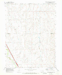
1969 Map of Noonen Reservoir SW
USGS Topo · Published 1973About this map
East Bijou Creek and its associated tributaries carve through this high plains landscape at the border of Arapahoe and Elbert counties. In the late 1960s, the southwestern corner of the quadrangle is defined by the heavy infrastructure of the Union Pacific railroad, which runs parallel to the creek bed. This transit corridor stands in contrast to the sparsely settled interior, where the land is marked by natural landmarks like Lowland and Badger. The map reveals an economy of resource extraction and ranching, evidenced by the scattered distribution of a Gravel Pit, an Oil Well, and various water wells. These small-scale industrial marks, alongside drainage systems like First Creek and Muddy Creek, provide a clear picture of how water and rail shaped land use in this open Colorado territory.
Find a feature on this map
11 named features on this map. Tap any name to fly to it.
Don’t see what you’re looking for? This feature index may not catch every label — zoom into the map to look around manually.
Map Details
Editions of this 1969 Noonen Reservoir SW Map
This is the sole edition of this map. No revisions or reprints were ever made.
Other maps of this area

1891 · Limon
USGS Topo · 1:125,000

1892 · Limon
USGS Topo · 1:125,000

1953 · Denver
USGS Topo · 1:250,000

1954 · Limon
USGS Topo · 1:250,000

1956 · Peoria
USGS Topo · 1:24,000

1957 · Denver
USGS Topo · 1:250,000

1957 · Limon
USGS Topo · 1:250,000

1958 · Limon
USGS Topo · 1:250,000

1958 · Denver
USGS Topo · 1:250,000

1960 · Denver
USGS Topo · 1:250,000