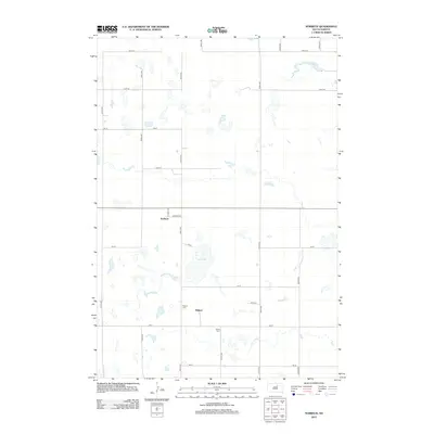
2012 Map of Norbeck
USGS Topo · Published 2012About this map
Norbeck and Millard anchor this section of Faulk County, revealing a landscape defined by isolated prairie basins and a rectilinear grid of county roads. The settlement of Norbeck is situated at the junction of S D Hwy 20 and Norbeck St, while the community of Millard lies further south, adjacent to the Millard Cem. This geography is shaped by numerous ephemeral wetlands and depressions, most notably the wide expanse of Dry Lake and the smaller Hammok Lake in the northeast. For genealogists and local historians, the inclusion of Myron Cem and the small-town street layouts provide specific spatial data for tracing family roots in this rural South Dakota township.
Find a feature on this map
24 named features on this map. Tap any name to fly to it.
Don’t see what you’re looking for? This feature index may not catch every label — zoom into the map to look around manually.
Map Details
Editions of this 2012 Norbeck Map
This is the sole edition of this map. No revisions or reprints were ever made.
Other maps of this area

1951 · Clark Lake
USGS Topo · 1:24,000

1952 · Norbeck
USGS Topo · 1:24,000

1952 · Burkmere
USGS Topo · 1:24,000

1952 · Wecota
USGS Topo · 1:24,000

1952 · Faulkton West
USGS Topo · 1:24,000

1952 · Faulkton East
USGS Topo · 1:24,000

1954 · Aberdeen
USGS Topo · 1:250,000

1956 · Aberdeen
USGS Topo · 1:250,000
1974 · Ipswich SE
USGS Topo · 1:24,000

1978 · Loyalton
USGS Topo · 1:24,000