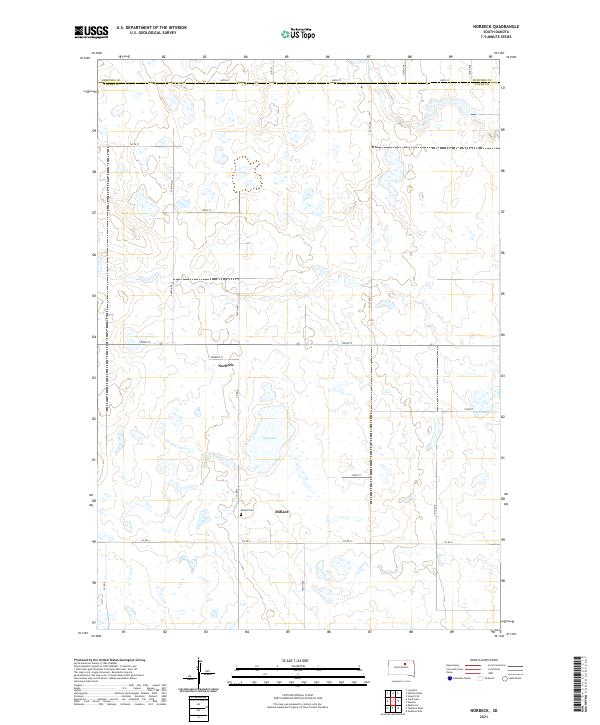
2021 Map of Norbeck
USGS Topo · Published 2021About this map
Millard and Norbeck anchor this section of the South Dakota prairie, situated along a network of section-line roads near the boundary of Edmunds Co and Faulk Co. The landscape is defined by the unique hydrology of the region, featuring Dry Lake and numerous smaller wetlands scattered across the plains. This 2021 survey illustrates the endurance of small agricultural settlements and the essential infrastructure that supports them, such as Co Rd 9 and 152nd St. For those researching local family history, the Millard Cem remains a significant landmark just west of the Millard townsite, providing a clear point of reference for the community's early residents and their ties to the surrounding townships of t120n r70w and t119n r69w.
Find a feature on this map
26 named features on this map. Tap any name to fly to it.
Don’t see what you’re looking for? This feature index may not catch every label — zoom into the map to look around manually.
Map Details
Editions of this 2021 Norbeck Map
This is the sole edition of this map. No revisions or reprints were ever made.
Other maps of this area

1951 · Clark Lake
USGS Topo · 1:24,000

1952 · Norbeck
USGS Topo · 1:24,000

1952 · Burkmere
USGS Topo · 1:24,000

1952 · Wecota
USGS Topo · 1:24,000

1952 · Faulkton West
USGS Topo · 1:24,000

1952 · Faulkton East
USGS Topo · 1:24,000

1954 · Aberdeen
USGS Topo · 1:250,000

1956 · Aberdeen
USGS Topo · 1:250,000
1974 · Ipswich SE
USGS Topo · 1:24,000

1978 · Loyalton
USGS Topo · 1:24,000