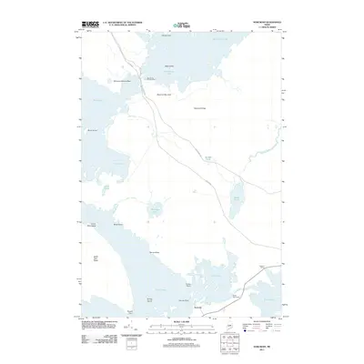
2011 Map of Norcross
USGS Topo · Published 2011About this map
Norcross serves as a critical junction for water and road transport in the North Maine Woods, situated where the Golden Rd and Millinocket Rd intersect near the southern reaches of the Twin Lakes. This 2011 survey highlights a landscape dominated by the complex hydrology of Millinocket Lake and the interconnected lake system, managed in part by the North Twin Dam. The area's character is defined by the legacy of the logging industry and recreational access, featuring the Big Moose Campground and the Millinocket Seaplane Base on the western shore of the lake. Geographic landmarks like Black Cat Mountain and Hammatt Ridge rise above the surrounding wetlands and ponds, including Wadleigh Pond and the slow-moving Smith Brook Deadwater. The map also identifies the Quakish Siding along the rail corridor, reflecting the continued importance of transport infrastructure in this timber-rich region of Penobscot County.
Find a feature on this map
29 named features on this map. Tap any name to fly to it.
Don’t see what you’re looking for? This feature index may not catch every label — zoom into the map to look around manually.
Map Details
Editions of this 2011 Norcross Map
This is the sole edition of this map. No revisions or reprints were ever made.
Other maps of this area

1927 · Katahdin
USGS Topo · 1:48,000

1930 · Katahdin
USGS Topo · 1:62,500

1949 · Katahdin
USGS Topo · 1:62,500

1951 · Norcross
USGS Topo · 1:62,500

1951 · Millinocket
USGS Topo · 1:62,500

1953 · Stacyville
USGS Topo · 1:62,500

1954 · Millinocket
USGS Topo · 1:250,000

1958 · Millinocket
USGS Topo · 1:250,000

1960 · Millinocket
USGS Topo · 1:250,000

1975 · Millinocket SW
USGS Topo · 1:24,000
Featured Places
- Millinocket, ME
- Ambejejus Lake, ME
- T3 Indian Purchase Township, ME
- T4 Indian Purchase Township, ME
- T1 R8 WELS, ME