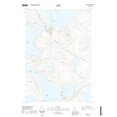
2021 Map of Norcross
USGS Topo · Published 2021About this map
Norcross sits at the southern edge of a complex waterway network where the West Branch of the Penobscot River flows through a series of interconnected lakes. This 2021 survey shows a landscape dominated by the vast surfaces of Millinocket Lake, North Twin Lake, and Pemadumcook Lake. The terrain is defined by prominent elevations such as Hammatt Ridge and Black Cat Mtn, which rise sharply from the forested basins. This modern topographic view captures the transition between Piscataquis Co and Penobscot Co, illustrating the intricate shoreline around Indian Point Island and Perrow Point. The road network consists primarily of routes like the Golden Rd and numerous fire roads, reflecting the region's managed timberlands and limited permanent settlement. Smaller water bodies like Wadleigh Pond and Elbow Lake are scattered throughout the low-lying wetlands, while Quakish Lake marks the eastern reach toward industrial centers.
Find a feature on this map
47 named features on this map. Tap any name to fly to it.
Don’t see what you’re looking for? This feature index may not catch every label — zoom into the map to look around manually.
Map Details
Editions of this 2021 Norcross Map
This is the sole edition of this map. No revisions or reprints were ever made.
Other maps of this area

1927 · Katahdin
USGS Topo · 1:48,000

1930 · Katahdin
USGS Topo · 1:62,500

1949 · Katahdin
USGS Topo · 1:62,500

1951 · Norcross
USGS Topo · 1:62,500

1951 · Millinocket
USGS Topo · 1:62,500

1953 · Stacyville
USGS Topo · 1:62,500

1954 · Millinocket
USGS Topo · 1:250,000

1958 · Millinocket
USGS Topo · 1:250,000

1960 · Millinocket
USGS Topo · 1:250,000

1975 · Millinocket SW
USGS Topo · 1:24,000
Featured Places
- Millinocket, ME
- Ambejejus Lake, ME
- T3 Indian Purchase Township, ME
- T4 Indian Purchase Township, ME
- T1 R8 WELS, ME