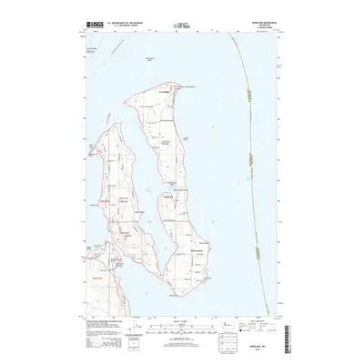
2014 Map of Nordland
USGS Topo · Published 2014About this map
Fort Flagler and the community of Nordland anchor this coastal landscape where the waters of Puget Sound meet the narrow passages of the Olympic Peninsula's eastern edge. The map highlights the maritime geography of Marrowstone Island and Indian Island, separated by the sheltered Kilisut Harbor and Scow Bay. Navigational safety is marked by the Point Hudson Lighthouse and Marrowstone Point Lighthouse, while the interior of the islands is crisscrossed by local routes like Flagler Campground Rd and Garden Club Rd. Genealogy and local history researchers can identify the location of Sound View Cem and the Po at Nordland, alongside diverse recreational points such as Mystery Bay State Park Marina and several vehicle parks. The northern tip is dedicated to Fort Flagler State Park, while the rugged shoreline is defined by landforms like Liplip Point, Nodule Point, and Bishops Point.
Find a feature on this map
75 named features on this map. Tap any name to fly to it.
Don’t see what you’re looking for? This feature index may not catch every label — zoom into the map to look around manually.
Map Details
Editions of this 2014 Nordland Map
This is the sole edition of this map. No revisions or reprints were ever made.
Other maps of this area

1937 · Port Gamble
USGS Topo · 1:62,500

1939 · Port Townsend
USGS Topo · 1:62,500

1939 · Coupeville
USGS Topo · 1:62,500

1940 · Port Gamble
USGS Topo · 1:62,500

1940 · Quilcene
USGS Topo · 1:62,500

1953 · Hansville
USGS Topo · 1:24,000

1953 · Coupeville
USGS Topo · 1:24,000

1953 · Freeland
USGS Topo · 1:24,000

1953 · Nordland
USGS Topo · 1:24,000

1953 · Center
USGS Topo · 1:24,000