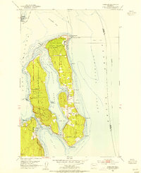
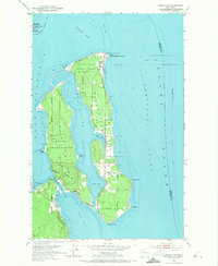
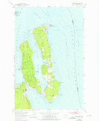
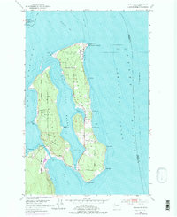
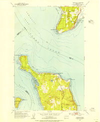
1953 Map of Nordland
USGS Topo · Published 1955About this map
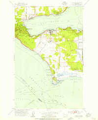
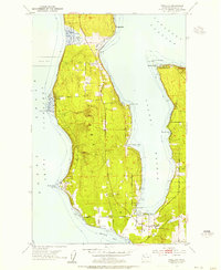
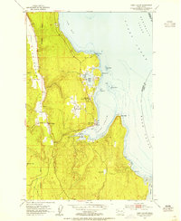
Marrowstone Island and Indian Island dominate this coastal survey, highlighting the heavy military and naval footprint on the Quimper Peninsula's eastern shores during the early 1950s. The northern tip of Marrowstone is occupied by the Fort Flagler Military Reservation, while the Indian Island Naval Reservation covers the adjacent landmass. Between these islands lies Kilisut Harbor, a sheltered waterway that reaches into Mystery Bay near the small settlement of Nordland.
Find a feature on this map
33 named features on this map. Tap any name to fly to it.
Don’t see what you’re looking for? This feature index may not catch every label — zoom into the map to look around manually.
Map Details
Editions of this 1953 Nordland Map
4 editions found
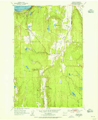
Other maps of this area

1937 · Port Gamble
USGS Topo · 1:62,500

1939 · Port Townsend
USGS Topo · 1:62,500

1939 · Coupeville
USGS Topo · 1:62,500

1940 · Port Gamble
USGS Topo · 1:62,500

1940 · Quilcene
USGS Topo · 1:62,500
1953 · Hansville
USGS Topo · 1:24,000
1953 · Coupeville
USGS Topo · 1:24,000
1953 · Freeland
USGS Topo · 1:24,000
1953 · Center
USGS Topo · 1:24,000
1953 · Port Ludlow
USGS Topo · 1:24,000