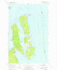
1953 Map of Nordland
USGS Topo · Published 1975About this map
Marrowstone Island and Indian Island dominate this coastal landscape, separated from the mainland by the waters of Port Townsend and Oak Bay. The settlement of Nordland sits centrally along Mystery Bay, serving as a focal point for the rural community during the mid-20th century. Military and maritime infrastructure is prominent, with the Coast Guard Reservation and Fort Flagler State Park occupying the northern tip at Marrowstone Point.
Find a feature on this map
36 named features on this map. Tap any name to fly to it.
Don’t see what you’re looking for? This feature index may not catch every label — zoom into the map to look around manually.
Map Details
Editions of this 1953 Nordland Map
4 editions found
Other maps of this area

1937 · Port Gamble
USGS Topo · 1:62,500

1939 · Port Townsend
USGS Topo · 1:62,500

1939 · Coupeville
USGS Topo · 1:62,500

1940 · Port Gamble
USGS Topo · 1:62,500

1940 · Quilcene
USGS Topo · 1:62,500

1953 · Hansville
USGS Topo · 1:24,000

1953 · Coupeville
USGS Topo · 1:24,000

1953 · Freeland
USGS Topo · 1:24,000

1953 · Nordland
USGS Topo · 1:24,000

1953 · Center
USGS Topo · 1:24,000