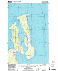
1998 Map of Nordland
USGS Topo · Published 2003About this map
Marrowstone Island and Indian Island dominate this coastal survey, defined by the narrow waters of Kilisut Harbor and the military legacy of the Olympic Peninsula entrance. At the northern tip of the island, Fort Flagler State Park and the Lighthouse at Marrowstone Point watch over the shipping lanes of Admiralty Inlet. The settlement of Nordland serves as the local anchor near Mystery Bay, while the landscape to the south transitions into the restricted grounds of a Naval Reservation.
Find a feature on this map
36 named features on this map. Tap any name to fly to it.
Don’t see what you’re looking for? This feature index may not catch every label — zoom into the map to look around manually.
Map Details
Editions of this 1998 Nordland Map
This is the sole edition of this map. No revisions or reprints were ever made.
Other maps of this area

1937 · Port Gamble
USGS Topo · 1:62,500

1939 · Port Townsend
USGS Topo · 1:62,500

1939 · Coupeville
USGS Topo · 1:62,500

1940 · Port Gamble
USGS Topo · 1:62,500

1940 · Quilcene
USGS Topo · 1:62,500

1953 · Hansville
USGS Topo · 1:24,000

1953 · Coupeville
USGS Topo · 1:24,000

1953 · Freeland
USGS Topo · 1:24,000

1953 · Nordland
USGS Topo · 1:24,000

1953 · Center
USGS Topo · 1:24,000