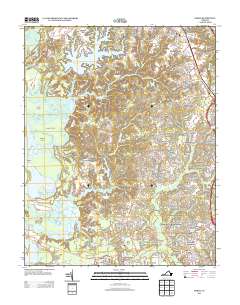
2013 Map of Norge
USGS Topo · Published 2013About this map
Norge and the surrounding James City County landscape are defined by a complex network of coastal waterways and modern residential expansion. The western edge of the quadrangle is dominated by the Chickahominy River and its intricate marshlands, including Wright Island and Simpson Island. Moving inland, the terrain is characterized by numerous water bodies such as the expansive Little Creek Reservoir, Jolly Pond, and Cranstons Pond, which have historically shaped the drainage and settlement patterns of the region.
Find a feature on this map
83 named features on this map. Tap any name to fly to it.
Don’t see what you’re looking for? This feature index may not catch every label — zoom into the map to look around manually.
Map Details
Editions of this 2013 Norge Map
This is the sole edition of this map. No revisions or reprints were ever made.
Other maps of this area

1906 · Williamsburg
USGS Topo · 1:62,500

1907 · Yorktown
USGS Topo · 1:62,500

1917 · Toano
USGS Topo · 1:62,500

1918 · Toano
USGS Topo · 1:62,500

1919 · Surry
USGS Topo · 1:62,500

1943 · Yorktown
USGS Topo · 1:62,500

1943 · Richmond
USGS Topo · 1:250,000

1949 · Richmond
USGS Topo · 1:250,000

1950 · Cobham Bay
USGS Topo · 1:24,000
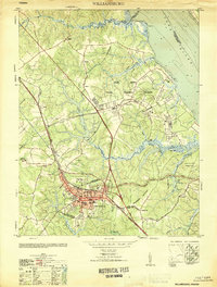
1951 · Williamsburg
USGS Topo · 1:24,000