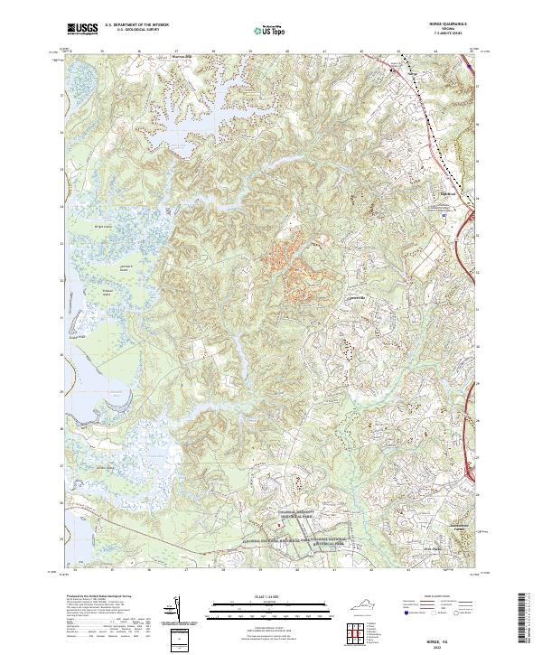
2022 Map of Norge
USGS Topo · Published 2022About this map
Norge and Lightfoot anchor the modern landscape of James City County in this recent survey, showcasing the continued growth of communities situated northwest of the colonial capital. The landscape is a complex intersection of suburban expansion and preserved land, most notably within the Colonial National Historical Park. Waterways like the Chickahominy River and Yarmouth Creek define the western boundaries, surrounding islands such as Wright Island and Yarmouth Island. This geography creates a distinct contrast between the developed corridors along Richmond Rd and the protected marshes and forests.
Find a feature on this map
166 named features on this map. Tap any name to fly to it.
Don’t see what you’re looking for? This feature index may not catch every label — zoom into the map to look around manually.
Map Details
Editions of this 2022 Norge Map
This is the sole edition of this map. No revisions or reprints were ever made.
Other maps of this area

1906 · Williamsburg
USGS Topo · 1:62,500

1907 · Yorktown
USGS Topo · 1:62,500

1917 · Toano
USGS Topo · 1:62,500

1918 · Toano
USGS Topo · 1:62,500

1919 · Surry
USGS Topo · 1:62,500

1943 · Yorktown
USGS Topo · 1:62,500

1943 · Richmond
USGS Topo · 1:250,000

1949 · Richmond
USGS Topo · 1:250,000

1950 · Cobham Bay
USGS Topo · 1:24,000
1951 · Williamsburg
USGS Topo · 1:24,000