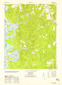
1952 Map of Norge
USGS Topo · Published 1958About this map
The Chickahominy River and the James River converge in this mid-century survey of the Virginia Peninsula, revealing a landscape defined by estuarine wetlands and historic landings. River access is a central theme, evidenced by features such as Barretta Ferry, Shipyard Landing, and Claybank Landing, which provided essential transit points before the modern highway era. Inland, the community of Norge sits along the Chesapeake and Ohio Railway, serving as a focal point for settlement alongside Lightfoot and Centerville.
Find a feature on this map
56 named features on this map. Tap any name to fly to it.
Don’t see what you’re looking for? This feature index may not catch every label — zoom into the map to look around manually.
Map Details
Editions of this 1952 Norge Map
This is the sole edition of this map. No revisions or reprints were ever made.
Other maps of this area

1906 · Williamsburg
USGS Topo · 1:62,500

1907 · Yorktown
USGS Topo · 1:62,500

1917 · Toano
USGS Topo · 1:62,500

1918 · Toano
USGS Topo · 1:62,500

1919 · Surry
USGS Topo · 1:62,500

1943 · Yorktown
USGS Topo · 1:62,500

1943 · Richmond
USGS Topo · 1:250,000

1949 · Richmond
USGS Topo · 1:250,000

1950 · Cobham Bay
USGS Topo · 1:24,000
1951 · Williamsburg
USGS Topo · 1:24,000