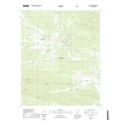
2020 Map of Norman
USGS Topo · Published 2020About this map
The Caddo River winds through this Montgomery County landscape, anchoring the settlements of Norman and Black Springs. This area of the Ouachita National Forest is defined by its ridge-and-valley topography, featuring prominent heights like Gap Mtn and the Fodderstack Range. Genealogists will find a wealth of burial sites scattered across the township lines, including Black Springs Cem, Montgomery Cem, and the more remote Tweedle-Vaught Cem south of Manfred. The map also captures several smaller communities such as Smoky Hollow and landmarks like the Crystal Mountains. Local infrastructure is marked by a network of forest and county roads, including Old Mt Ida Hwy and Collier Springs Rd, which provide access to the timbered slopes and creek bottoms of Huddleston Cr and Hyatt Cr.
Find a feature on this map
70 named features on this map. Tap any name to fly to it.
Don’t see what you’re looking for? This feature index may not catch every label — zoom into the map to look around manually.
Map Details
Editions of this 2020 Norman Map
This is the sole edition of this map. No revisions or reprints were ever made.
Other maps of this area

1890 · Mount Ida
USGS Topo · 1:125,000

1906 · Caddo Gap
USGS Topo · 1:125,000

1936 · Athens
USGS Topo · 1:48,000

1936 · Glenwood
USGS Topo · 1:48,000

1942 · Glenwood
USGS Topo · 1:62,500

1942 · Athens
USGS Topo · 1:62,500

1949 · Glenwood
USGS Topo · 1:62,500

1955 · Little Rock
USGS Topo · 1:250,000

1956 · Little Rock
USGS Topo · 1:250,000

1959 · Oden
USGS Topo · 1:62,500