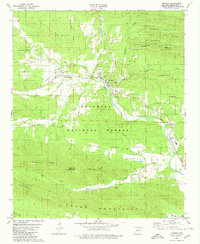
1979 Map of Norman
USGS Topo · Published 1980About this map
The Caddo River carves a path through the Montgomery County hills, anchoring a landscape defined by the Ouachita National Forest and the rugged ridges of the Crystal Mountains and Caddo Mountains. This survey documents a quiet rural pocket where the town of Norman and the settlement of Black Springs serve as primary hubs, connected by the winding route of the Missouri Pacific railroad. The map reveals a land utilized for both recreation and local industry, featuring the Crystal Recreation Area and a Shale Pit near Huddleston Creek. Along the river's edge, critical infrastructure like a Gaging Station and a Radio Tower stand near the valley floor. To the south, the terrain rises into the Fodderstack Range, while cultural landmarks such as Caddo Hills Sch and the Chapel Cem mark the enduring community footprint in this heavily forested region.
Find a feature on this map
47 named features on this map. Tap any name to fly to it.
Don’t see what you’re looking for? This feature index may not catch every label — zoom into the map to look around manually.
Map Details
Editions of this 1979 Norman Map
This is the sole edition of this map. No revisions or reprints were ever made.
Other maps of this area

1890 · Mount Ida
USGS Topo · 1:125,000

1906 · Caddo Gap
USGS Topo · 1:125,000

1936 · Athens
USGS Topo · 1:48,000

1936 · Glenwood
USGS Topo · 1:48,000

1942 · Glenwood
USGS Topo · 1:62,500

1942 · Athens
USGS Topo · 1:62,500

1949 · Glenwood
USGS Topo · 1:62,500

1955 · Little Rock
USGS Topo · 1:250,000

1956 · Little Rock
USGS Topo · 1:250,000

1959 · Oden
USGS Topo · 1:62,500