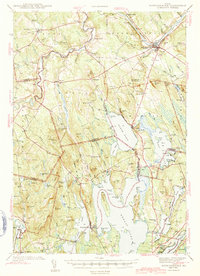
1943 Map of Norridgewock
USGS Topo · Published 1943About this map
The Kennebec River and Sandy River converge in this mid-century portrait of Somerset, Franklin, and Kennebec Counties. The landscape is defined by an extensive network of waterways, including the elongated basins of North Pond, East Pond, and Great Pond. These lakes, alongside Messalonskee Lake, illustrate the region's complex glacial topography. Settlement patterns are focused around traditional town centers like Norridgewock, Mercer, and Vienna, while the interior is dotted with rural institutions such as the Whittier School and Hersom School. Transportation in the early 1940s relied on the Maine Central Railroad, which provided a critical link for communities like North Belgrade Station. Numerous family-named landmarks and cemeteries, including Whitehouse Cemetery and Ladd Cemetery, offer significant points of interest for those tracing the local genealogy of these Maine townships.
Find a feature on this map
113 named features on this map. Tap any name to fly to it.
Don’t see what you’re looking for? This feature index may not catch every label — zoom into the map to look around manually.
Map Details
Editions of this 1943 Norridgewock Map
3 editions found

Other maps of this area

1892 · Waterville
USGS Topo · 1:62,500

1892 · Augusta
USGS Topo · 1:62,500

1893 · Vassalboro
USGS Topo · 1:62,500

1894 · Norridgewock
USGS Topo · 1:62,500

1898 · Norridgewock
USGS Topo · 1:62,500

1898 · Vassalboro
USGS Topo · 1:62,500

1904 · Anson
USGS Topo · 1:62,500

1910 · Livermore
USGS Topo · 1:62,500

1912 · Livermore
USGS Topo · 1:62,500

1913 · Skowhegan
USGS Topo · 1:62,500