2022 Map of Norris
USGS Topo · Published 2022About this map
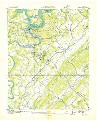
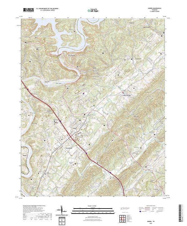
The Clinch River snakes through the center of this Anderson County landscape, defined by the planned community of Norris and the surrounding ridges of Big Valley. The terrain is characterized by steep slopes and deep hollows, such as Massengill Hollow and Gooseneck Hollow, which dictate the winding paths of roads like the Norris Fwy. Above the dam, Norris Lake spreads into its northern reaches near Cove Creek, while the southern portion of the sheet transitions into the more industrial and residential outskirts of Clinton.
Find a feature on this map
187 named features on this map. Tap any name to fly to it.
Don’t see what you’re looking for? This feature index may not catch every label — zoom into the map to look around manually.
Map Details
Editions of this 2022 Norris Map
This is the sole edition of this map. No revisions or reprints were ever made.
Historical Maps of Mill Creek Through Time
5 maps found