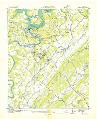
1936 Map of Norris
USGS Topo · Published 1936About this map
Norris Dam stands as the focal point of this Tennessee Valley Authority landscape, capturing the region just as the Norris Reservoir was taking its modern shape. The surrounding terrain is a mix of planned government infrastructure and long-standing rural community hubs. Civil Conservation Corps activity is prominent, with C C C Camp No 494 and C C C Camp Nos 4493-5 established near the planned community of Norris. This era marks a significant transition in land use, where the new Norris Town Forest and Norris Park began to overlay the traditional agricultural valleys. Local heritage is preserved in the naming of rural landmarks like Loys Mill and Island Ford Ch, while the Tennessee Freeway provides a glimpse into the early modernization of regional transit routes connecting Andersonville to the wider Clinch River valley.
Find a feature on this map
71 named features on this map. Tap any name to fly to it.
Don’t see what you’re looking for? This feature index may not catch every label — zoom into the map to look around manually.
Map Details
Editions of this 1936 Norris Map
This is the sole edition of this map. No revisions or reprints were ever made.
Other maps of this area

1893 · Briceville
USGS Topo · 1:125,000

1895 · Briceville
USGS Topo · 1:125,000

1896 · Briceville
USGS Topo · 1:125,000

1897 · Maynardville
USGS Topo · 1:125,000

1900 · Maynardville
USGS Topo · 1:125,000

1935 · Fountain City
USGS Topo · 1:24,000

1936 · Gorryton
USGS Topo · 1:48,000

1936 · Jacksboro
USGS Topo · 1:24,000

1936 · White Hollow
USGS Topo · 1:24,000

1936 · La Follette
USGS Topo · 1:48,000