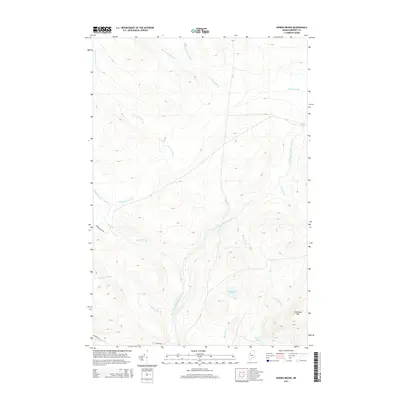
2014 Map of Norris Brook
USGS Topo · Published 2014About this map
The North Branch Penobscot River winds through this Somerset County landscape, serving as the central drainage for a network of named brooks and wetlands. To the south, the terrain rises toward Truesdale Mtn, overlooking Truesdale Pond and Spencer Pond. This 2014 survey documents a remote timberland environment where human activity is primarily represented by the industrial access of Golden Rd and Norris Brook Rd. The map illustrates a complex hydraulic system including Big Bog and several major tributaries such as Rainey Brook, Misere Brook, and Budworm Brook. These features define the geography of Big Six Township, highlighting the dense concentration of water resources and specialized logging infrastructure that characterizes this portion of Northern Maine.
Find a feature on this map
18 named features on this map. Tap any name to fly to it.
Don’t see what you’re looking for? This feature index may not catch every label — zoom into the map to look around manually.
Map Details
Editions of this 2014 Norris Brook Map
This is the sole edition of this map. No revisions or reprints were ever made.
Other maps of this area

1949 · Jackman
USGS Topo · 1:250,000

1954 · Seboomook Lake
USGS Topo · 1:62,500

1954 · St. John Pond
USGS Topo · 1:62,500

1954 · Presque Isle
USGS Topo · 1:250,000

1954 · Millinocket
USGS Topo · 1:250,000

1956 · Penobscot Lake
USGS Topo · 1:62,500

1957 · Norris Brook
USGS Topo · 1:62,500

1958 · Presque Isle
USGS Topo · 1:250,000

1958 · Millinocket
USGS Topo · 1:250,000

1958 · Saint John Pond
USGS Topo · 1:62,500