
1969 Map of Norris
USGS Topo · Published 1971About this map
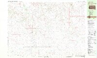
Rosebud Indian Reservation land dominates this section of the Great Plains, where the winding course of Black Pipe Creek cuts through the high prairie. The settlement of Norris serves as a local hub, situated near several significant community sites including Norris Cem and a nearby Gravel Pit. The map reveals a landscape defined by traditional land use and tribal heritage, marked by the presence of Poor Thunder Cem, Red Leaf Cem, and Indian Cem.
Find a feature on this map
23 named features on this map. Tap any name to fly to it.
Don’t see what you’re looking for? This feature index may not catch every label — zoom into the map to look around manually.
Map Details
Editions of this 1969 Norris Map
This is the sole edition of this map. No revisions or reprints were ever made.
Other maps of this area

1955 · Martin
USGS Topo · 1:250,000

1958 · Martin
USGS Topo · 1:250,000

1969 · Eagle Mans Butte
USGS Topo · 1:24,000

1969 · Parmelee NE
USGS Topo · 1:24,000

1969 · Parmelee
USGS Topo · 1:24,000

1980 · Kadoka
USGS Topo · 1:100,000

1981 · Cedar Butte
USGS Topo · 1:25,000

1981 · Long Valley
USGS Topo · 1:25,000

1981 · Blackpipe
USGS Topo · 1:25,000
1981 · Short Bow Creek
USGS Topo · 1:25,000