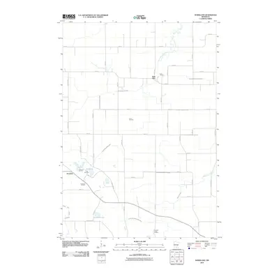
2010 Map of Norseland
USGS Topo · Published 2010About this map
Norseland and Rush River anchor this rural landscape in Nicollet County, defined by a meticulously managed watershed of natural streams and agricultural drainage systems. The South Branch Rush River winds through the northern portion of the map, while numerous numbered ditches, including County Ditch Number Seventyfive and Judicial Ditch Number Thirteen, illustrate the extensive engineering of the local prairie for farming. For genealogists and local historians, the sheet is particularly valuable for its density of burial sites, featuring the Norseland Cemetery, Anderson Family Cemetery, Methodist Cemetery, Traver Cemetery, and Sauer Cemetery. Recreational and social life is marked by Camp Norseland situated near the shores of Sand Lake, providing a clear view of the area's community structure in the early 21st century.
Find a feature on this map
45 named features on this map. Tap any name to fly to it.
Don’t see what you’re looking for? This feature index may not catch every label — zoom into the map to look around manually.
Map Details
Editions of this 2010 Norseland Map
This is the sole edition of this map. No revisions or reprints were ever made.
Other maps of this area

1953 · Saint Paul
USGS Topo · 1:250,000

1953 · New Ulm
USGS Topo · 1:250,000

1957 · New Ulm
USGS Topo · 1:250,000

1957 · Belle Plaine
USGS Topo · 1:62,500

1958 · New Ulm
USGS Topo · 1:250,000

1958 · Gaylord
USGS Topo · 1:62,500

1959 · Saint Paul
USGS Topo · 1:250,000

1965 · Norseland
USGS Topo · 1:24,000

1965 · New Sweden
USGS Topo · 1:24,000

1965 · North Star
USGS Topo · 1:24,000