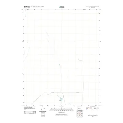
2010 Map of North Avondale NE
USGS Topo · Published 2010About this map
Thatcher Reservoir and its associated Thatcher Dam anchor the southern portion of this landscape, serving as a vital water catchment point in an otherwise arid stretch of Pueblo County. The drainage patterns are defined by the intermittent flows of Haynes Creek, which meanders south toward the reservoir, and Black Squirrel Creek in the northwest. This 2010 survey highlights a sparsely developed region where infrastructure is primarily limited to utility and ranching access, notably along Dot Test Rd and Il Ranch Rd. The map illustrates a high-plains environment where water management and large-scale landholdings dictate the sparse human footprint.
Find a feature on this map
6 named features on this map. Tap any name to fly to it.
Don’t see what you’re looking for? This feature index may not catch every label — zoom into the map to look around manually.
Map Details
Editions of this 2010 North Avondale NE Map
This is the sole edition of this map. No revisions or reprints were ever made.
Other maps of this area

1891 · Nepesta
USGS Topo · 1:125,000

1893 · Nepesta
USGS Topo · 1:125,000

1893 · Big Springs
USGS Topo · 1:125,000

1904 · Nepesta
USGS Topo · 1:125,000
1954 · Hanover
USGS Topo · 1:24,000

1954 · Pueblo
USGS Topo · 1:250,000

1957 · Pueblo
USGS Topo · 1:250,000

1958 · Pueblo
USGS Topo · 1:250,000

1959 · Highlands Church
USGS Topo · 1:24,000

1959 · North Avondale NE
USGS Topo · 1:24,000