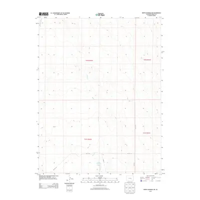
2013 Map of North Avondale NE
USGS Topo · Published 2013About this map
Thatcher Reservoir serves as a primary water landmark in this stretch of eastern Colorado, where the arid landscape is defined by its drainages. The map reveals a high-plains topography dominated by the seasonal paths of Black Squirrel Cr and Haynes Cr. This terrain, organized under the Public Land Survey System, shows a distinct transition between Township 18 South and Township 19 South. The sparse infrastructure is limited to specialized routes like Dot Test Rd and Il Ranch Rd, reflecting the area's use for ranching and technical testing. The layout of these ranch roads and the scattered water features provide essential data for understanding land management and water rights in this rural portion of Pueblo County during the early twenty-first century.
Find a feature on this map
9 named features on this map. Tap any name to fly to it.
Don’t see what you’re looking for? This feature index may not catch every label — zoom into the map to look around manually.
Map Details
Editions of this 2013 North Avondale NE Map
This is the sole edition of this map. No revisions or reprints were ever made.
Other maps of this area

1891 · Nepesta
USGS Topo · 1:125,000

1893 · Nepesta
USGS Topo · 1:125,000

1893 · Big Springs
USGS Topo · 1:125,000

1904 · Nepesta
USGS Topo · 1:125,000
1954 · Hanover
USGS Topo · 1:24,000

1954 · Pueblo
USGS Topo · 1:250,000

1957 · Pueblo
USGS Topo · 1:250,000

1958 · Pueblo
USGS Topo · 1:250,000

1959 · Highlands Church
USGS Topo · 1:24,000

1959 · North Avondale NE
USGS Topo · 1:24,000