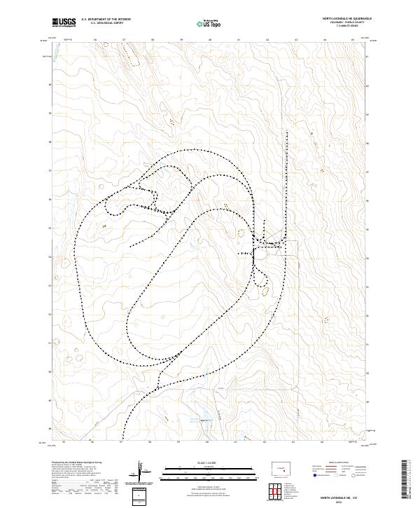
2022 Map of North Avondale NE
USGS Topo · Published 2022About this map
Thatcher Reservoir lies at the southern edge of this landscape, serving as a primary water source in a region defined by intermittent drainage and rural ranching infrastructure. The terrain is marked by the meandering courses of Haynes Cr and Black Squirrel Cr, which carve subtle paths through the high plains of Pueblo County. The human footprint here is primarily composed of a sparse road network, including Co Rd 3 and Thatcher Rd, which facilitate movement between the expansive rangelands. The division of land into sections like t18s r61w and t19s r62w illustrates the enduring influence of the Public Land Survey System on the modern Colorado landscape.
Find a feature on this map
10 named features on this map. Tap any name to fly to it.
Don’t see what you’re looking for? This feature index may not catch every label — zoom into the map to look around manually.
Map Details
Editions of this 2022 North Avondale NE Map
This is the sole edition of this map. No revisions or reprints were ever made.
Other maps of this area

1891 · Nepesta
USGS Topo · 1:125,000

1893 · Nepesta
USGS Topo · 1:125,000

1893 · Big Springs
USGS Topo · 1:125,000

1904 · Nepesta
USGS Topo · 1:125,000
1954 · Hanover
USGS Topo · 1:24,000

1954 · Pueblo
USGS Topo · 1:250,000

1957 · Pueblo
USGS Topo · 1:250,000

1958 · Pueblo
USGS Topo · 1:250,000

1959 · Highlands Church
USGS Topo · 1:24,000

1959 · North Avondale NE
USGS Topo · 1:24,000