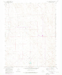
1960 Map of North Avondale NE
USGS Topo · Published 1972About this map
High Speed Ground Test Center occupies a significant portion of this Colorado landscape, reflecting the federal investment in specialized infrastructure during the mid-20th century. The terrain is defined by the drainage patterns of Black Squirrel Cr and Haynes Creek, which cut through the arid plains of Pueblo County. Industrial and transportation developments are visible in the purple revisions of the 1970s, including sections of road marked Under Construction. Local landmarks such as the Spillway and several bench marks like Vabm 4914 provide essential orientation points for those tracking land use and surveying history in this semi-arid region. The map also captures a network of utilitarian routes, including a Jeep Trail, illustrating how the land was navigated before modern paving reached these sections of the township.
Find a feature on this map
14 named features on this map. Tap any name to fly to it.
Don’t see what you’re looking for? This feature index may not catch every label — zoom into the map to look around manually.
Map Details
Editions of this 1960 North Avondale NE Map
This is the sole edition of this map. No revisions or reprints were ever made.
Other maps of this area

1891 · Nepesta
USGS Topo · 1:125,000

1893 · Nepesta
USGS Topo · 1:125,000

1893 · Big Springs
USGS Topo · 1:125,000

1904 · Nepesta
USGS Topo · 1:125,000
1954 · Hanover
USGS Topo · 1:24,000

1954 · Pueblo
USGS Topo · 1:250,000

1957 · Pueblo
USGS Topo · 1:250,000

1958 · Pueblo
USGS Topo · 1:250,000

1959 · Highlands Church
USGS Topo · 1:24,000

1959 · North Avondale NE
USGS Topo · 1:24,000