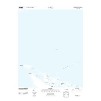
2013 Map of North Bay
USGS Topo · Published 2013About this map
Cedar Island serves as the terminal hub for coastal transit on this section of the Outer Banks, where maritime life and transportation intersect. The map traces the critical Ocracoke-Cedar Island - Ferry Crossing route, which links the mainland via the Ferry Landing at the Head of Bay. This landscape is defined by its shifting sands and intricate waterways, featuring prominent coastal landmarks such as Point of Grass, Raymond Sand, and the Goodwin Hills. Beyond the residential and transit infrastructure of Sound View Dr, the environment dissolves into a complex system of marshes and smaller landmasses. Researchers can trace the hydrography of the sound side, identifying North Bay and the narrow passages of Snake Gut, Fullers Ditch, and Deep Slough that wind through Hog Island and Hunting Island.
Find a feature on this map
22 named features on this map. Tap any name to fly to it.
Don’t see what you’re looking for? This feature index may not catch every label — zoom into the map to look around manually.
Map Details
Editions of this 2013 North Bay Map
This is the sole edition of this map. No revisions or reprints were ever made.
Other maps of this area

1948 · North Bay
USGS Topo · 1:24,000

1949 · Atlantic
USGS Topo · 1:24,000

1949 · Point Of Marsh
USGS Topo · 1:24,000

1949 · Long Bay
USGS Topo · 1:24,000

1950 · Long Bay
USGS Topo · 1:24,000

1950 · North Bay
USGS Topo · 1:24,000

1950 · Point Of Marsh
USGS Topo · 1:24,000
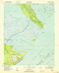
1951 · Atlantic
USGS Topo · 1:24,000

1951 · Brant Island
USGS Topo · 1:24,000

1953 · Rocky Mount
USGS Topo · 1:250,000