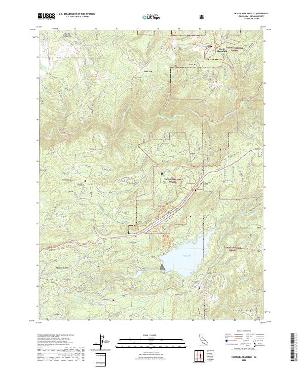
2022 Map of North Bloomfield
USGS Topo · Published 2022About this map
North Bloomfield and the adjacent North Bloomfield Cem serve as the focal point for this survey of the historic San Juan Ridge. This gold-country landscape is defined by the steep canyons of the South Yuba River and the S Yuba River, where the terrain transitions from high ridges like Washington Ridge and Harmony Ridge into deep drainages such as New York Canyon and Missouri Canyon. Evidence of the region’s hydraulic mining heritage is visible in the network of trails and roads connecting long-standing settlements like North Columbia, Lake City, and Quaker Hill. To the south, the Scotts Flat Reservoir collects waters from Deer Cr, a primary drainage for the area. The map illustrates a complex geography where the residential areas of Willow-Valley meet the expansive timberlands of the Tahoe National Forest.
Find a feature on this map
218 named features on this map. Tap any name to fly to it.
Don’t see what you’re looking for? This feature index may not catch every label — zoom into the map to look around manually.
Map Details
Editions of this 2022 North Bloomfield Map
This is the sole edition of this map. No revisions or reprints were ever made.
Other maps of this area

1888 · Smartsville
USGS Topo · 1:125,000

1891 · Colfax
USGS Topo · 1:125,000

1891 · Smartsville
USGS Topo · 1:125,000

1892 · Smartsville
USGS Topo · 1:125,000

1892 · Colfax
USGS Topo · 1:125,000

1894 · Colfax
USGS Topo · 1:125,000

1894 · Smartsville
USGS Topo · 1:125,000

1895 · Smartsville
USGS Topo · 1:125,000

1898 · Colfax
USGS Topo · 1:125,000

1900 · Colfax
USGS Topo · 1:125,000