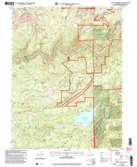
2000 Map of North Bloomfield
USGS Topo · Published 2003About this map
Malakoff Diggings dominates the northern landscape of this Nevada County quadrangle, showing the lasting environmental footprint of hydraulic mining operations in the Gold Country. The rugged terrain is carved by the South Fork Yuba River and Humbug Creek, with historical settlements like North Bloomfield and North Columbia serving as anchors for the local history. Several deep-rock mining sites, including the Hoge Mine and St Louis Mine, are scattered across the ridges, while the Blue Tent School and a Pioneer Grave offer tangible links to the area's early social fabric.
Find a feature on this map
65 named features on this map. Tap any name to fly to it.
Don’t see what you’re looking for? This feature index may not catch every label — zoom into the map to look around manually.
Map Details
Editions of this 2000 North Bloomfield Map
This is the sole edition of this map. No revisions or reprints were ever made.
Other maps of this area

1888 · Smartsville
USGS Topo · 1:125,000

1891 · Colfax
USGS Topo · 1:125,000

1891 · Smartsville
USGS Topo · 1:125,000

1892 · Smartsville
USGS Topo · 1:125,000

1892 · Colfax
USGS Topo · 1:125,000

1894 · Colfax
USGS Topo · 1:125,000

1894 · Smartsville
USGS Topo · 1:125,000

1895 · Smartsville
USGS Topo · 1:125,000

1898 · Colfax
USGS Topo · 1:125,000

1900 · Colfax
USGS Topo · 1:125,000