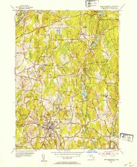
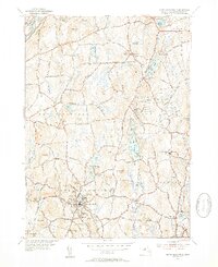
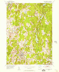
1952 Map of North Brookfield
USGS Topo · Published 1954About this map
North Brookfield serves as the primary population center on this mid-century Worcester County survey, surrounded by a dense network of family-named hills and cemeteries that define the local genealogy. The landscape is characterized by its numerous small water bodies, such as Brooks Pond and Dean Pond, which feed into the Fivemile River and Sevenmile River. Significant religious and memorial landmarks are scattered across the terrain, including the expansive grounds of St Josephs Abbey and the Walnut Grove Cem.
Find a feature on this map
59 named features on this map. Tap any name to fly to it.
Don’t see what you’re looking for? This feature index may not catch every label — zoom into the map to look around manually.
Map Details
Editions of this 1952 North Brookfield Map
4 editions found

Other maps of this area

1885 · Worcester
USGS Topo · 1:62,500

1886 · Worcester
USGS Topo · 1:62,500

1887 · Brookfield
USGS Topo · 1:62,500

1887 · Barre
USGS Topo · 1:62,500

1889 · Webster
USGS Topo · 1:62,500

1889 · Barre
USGS Topo · 1:62,500

1890 · Brookfield
USGS Topo · 1:62,500

1892 · Webster
USGS Topo · 1:62,500

1892 · Worcester
USGS Topo · 1:62,500

1893 · Brookfield
USGS Topo · 1:62,500