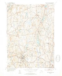
1952 Map of North Brookfield
USGS Topo · Published 1954About this map
North Brookfield and the surrounding townships of Oakham and Spencer are depicted here during the mid-twentieth century, showing a landscape defined by industrial legacy and institutional presence. The town center of North Brookfield is densely mapped, featuring several civic structures and the Walnut Grove Cem, while the St Josephs Abbey sits to the east, north of Hillsville. The topography is a series of glacial hills including Tower Hill and Bell Hill, interspersed with numerous bodies of water such as Brooks Pond and Dean Pond.
Find a feature on this map
61 named features on this map. Tap any name to fly to it.
Don’t see what you’re looking for? This feature index may not catch every label — zoom into the map to look around manually.
Map Details
Editions of this 1952 North Brookfield Map
4 editions found
Other maps of this area

1885 · Worcester
USGS Topo · 1:62,500

1886 · Worcester
USGS Topo · 1:62,500

1887 · Brookfield
USGS Topo · 1:62,500

1887 · Barre
USGS Topo · 1:62,500

1889 · Webster
USGS Topo · 1:62,500

1889 · Barre
USGS Topo · 1:62,500

1890 · Brookfield
USGS Topo · 1:62,500

1892 · Webster
USGS Topo · 1:62,500

1892 · Worcester
USGS Topo · 1:62,500

1893 · Brookfield
USGS Topo · 1:62,500