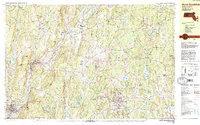
1982 Map of North Brookfield
USGS Topo · Published 1984About this map
Central Massachusetts villages like North Brookfield and Hardwick define the character of this 1980s landscape, where industrial remnants meet expansive wildlife conservation areas. The Ware River flows through the western terrain, flanked by the Ware River Wildlife Management Area and the historic settlement of Gilbertville. This era shows a community still anchored by its traditional institutions, including the prominent St Josephs Abbey and Pioneer Valley Academy.
Find a feature on this map
77 named features on this map. Tap any name to fly to it.
Don’t see what you’re looking for? This feature index may not catch every label — zoom into the map to look around manually.
Map Details
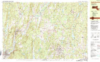
Editions of this 1982 North Brookfield Map
2 editions found
Other maps of this area

1885 · Worcester
USGS Topo · 1:62,500

1886 · Worcester
USGS Topo · 1:62,500

1887 · Brookfield
USGS Topo · 1:62,500

1887 · Palmer
USGS Topo · 1:62,500

1887 · Belchertown
USGS Topo · 1:62,500

1887 · Barre
USGS Topo · 1:62,500

1889 · Webster
USGS Topo · 1:62,500

1889 · Palmer
USGS Topo · 1:62,500

1889 · Barre
USGS Topo · 1:62,500

1890 · Belchertown
USGS Topo · 1:62,500