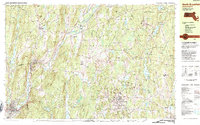
1982 Map of North Brookfield
USGS Topo · Published 1984About this map
The hills of central Worcester County are meticulously documented in this 1980s topographic record, showing the established communities of North Brookfield, Hardwick, and New Braintree during a period of agricultural and institutional stability. The landscape is defined by its many summits, from Mandell Hill to Ragged Hill, interspersed with water features like Hardwick Pond and the Quaboag River in the south. The presence of specialized institutions is a notable characteristic of this era, including the St Josephs Abbey complex, Pioneer Valley Academy, and the Eagle Hill Sch in Hardwick.
Find a feature on this map
110 named features on this map. Tap any name to fly to it.
Don’t see what you’re looking for? This feature index may not catch every label — zoom into the map to look around manually.
Map Details
Editions of this 1982 North Brookfield Map
2 editions found
Other maps of this area

1885 · Worcester
USGS Topo · 1:62,500

1886 · Worcester
USGS Topo · 1:62,500

1887 · Brookfield
USGS Topo · 1:62,500

1887 · Palmer
USGS Topo · 1:62,500

1887 · Belchertown
USGS Topo · 1:62,500

1887 · Barre
USGS Topo · 1:62,500

1889 · Webster
USGS Topo · 1:62,500

1889 · Palmer
USGS Topo · 1:62,500

1889 · Barre
USGS Topo · 1:62,500

1890 · Belchertown
USGS Topo · 1:62,500