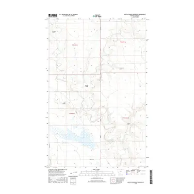
2017 Map of North Chinook Reservoir
USGS Topo · Published 2017About this map
North Chinook Reservoir sits at the heart of this high plains landscape in northern Montana, serving as a primary hydrological feature within the drainage basin of Battle Cr. The terrain is defined by a series of distinct erosional draws and depressions, including Corregan Coulee, Burrell Coulee, and Scotchmans Coulee, which channel seasonal runoff toward the reservoir. These coulees reveal the intricate topography typical of the region's semi-arid environment.
Find a feature on this map
15 named features on this map. Tap any name to fly to it.
Don’t see what you’re looking for? This feature index may not catch every label — zoom into the map to look around manually.
Map Details
Editions of this 2017 North Chinook Reservoir Map
This is the sole edition of this map. No revisions or reprints were ever made.
Other maps of this area

1904 · Yantic
USGS Topo · 1:62,500

1904 · Chinook
USGS Topo · 1:62,500

1912 · Zurich
USGS Topo · 1:125,000

1953 · Havre
USGS Topo · 1:250,000

1957 · Havre
USGS Topo · 1:250,000

1958 · Havre
USGS Topo · 1:250,000

1964 · Rabbit Hills
USGS Topo · 1:24,000

1964 · Telescope Coulee
USGS Topo · 1:24,000
1964 · Reservoir Coulee
USGS Topo · 1:24,000
1984 · Richmond Reservoir SW
USGS Topo · 1:24,000