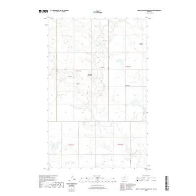
2020 Map of North Chinook Reservoir NW
USGS Topo · Published 2020About this map
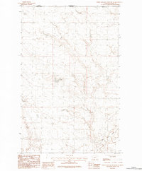
Hartland Colony sits at the center of this high-plains landscape, where the agricultural community is defined by a network of drainage channels and coulees. The terrain is marked by the winding course of Battle Cr, which flows through the northern and central sections, carving out landforms like Corregan Coulee and Twin Coulee. This 2020 record of north-central Montana shows a sparsely populated area where life is organized around the section lines of the Public Land Survey System and local thoroughfares such as Woodpile Rd and Ellome Rd. The map illustrates the persistence of the Hutterite settlement pattern in the region, with the colony's infrastructure concentrated south of Woodpile Coulee. To the south, Hay Coulee further defines the geography of the Hill and Blaine county line, reflecting a landscape where water and topography dictate the movement of people and livestock.
Find a feature on this map
13 named features on this map. Tap any name to fly to it.
Don’t see what you’re looking for? This feature index may not catch every label — zoom into the map to look around manually.
Map Details
Editions of this 2020 North Chinook Reservoir NW Map
This is the sole edition of this map. No revisions or reprints were ever made.
Other maps of this area

1912 · Zurich
USGS Topo · 1:125,000

1912 · Thibedeau Lake
USGS Topo · 1:125,000

1953 · Havre
USGS Topo · 1:250,000

1957 · Havre
USGS Topo · 1:250,000

1958 · Havre
USGS Topo · 1:250,000
1972 · Lake Thibadeau
USGS Topo · 1:24,000
1972 · Lake Thibadeau NE
USGS Topo · 1:24,000
1984 · Mc Laren Reservoir
USGS Topo · 1:24,000

1984 · Havre
USGS Topo · 1:100,000
1984 · North Chinook Reservoir NE
USGS Topo · 1:24,000