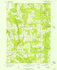
1954 Map of North Clymer
USGS Topo · Published 1957About this map
Dairy country and woodlots define the landscape of Chautauqua County in the mid-1950s, where the Pennsylvania Railroad cuts a north-south path through the valley. This transit line supported small agricultural hubs like North Clymer, which served as a rail point at Panama Sta. The map reveals a network of upland farms connected by roads often named for local families, including Bailey Road and Ten Maken Road.
Find a feature on this map
47 named features on this map. Tap any name to fly to it.
Don’t see what you’re looking for? This feature index may not catch every label — zoom into the map to look around manually.
Map Details
Editions of this 1954 North Clymer Map
3 editions found
Other maps of this area

1904 · Chautaqua
USGS Topo · 1:62,500

1905 · Clymer
USGS Topo · 1:62,500

1926 · Youngsville
USGS Topo · 1:62,500

1929 · Corry
USGS Topo · 1:48,000

1929 · Youngsville
USGS Topo · 1:62,500

1932 · Corry
USGS Topo · 1:62,500

1939 · Clymer
USGS Topo · 1:62,500

1941 · Chautauqua
USGS Topo · 1:62,500

1941 · Clymer
USGS Topo · 1:62,500

1943 · Youngsville
USGS Topo · 1:62,500