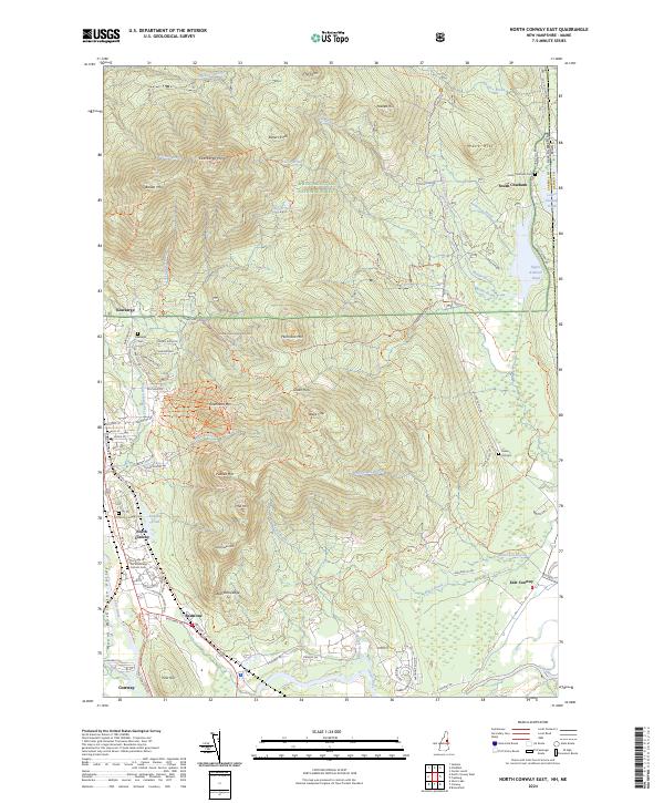
2024 Map of North Conway East
USGS Topo · Published 2024About this map
White Mountain National Forest dominates the high-altitude terrain of this quadrangle, where the granite peaks of Kearsarge North and Black Cap overlook the Mount Washington Valley. The transition from wilderness to settlement is sharp, with the eastern slopes of Cranmore Mtn and Hurricane Mtn descending into the populated corridors of North Conway and Kearsarge. The lower elevations are shaped by the Saco River and its numerous tributaries, including Artist Brook and Mason Brook, which have historically driven the local geography. Along the southern edge, the village of Redstone and the nearby Redstone Ledge point to the area's geological and industrial heritage. For those tracing local history, several burial grounds are scattered across the landscape, from the South Chatham Cem near the state line to the Our Lady of the Mountains Catholic Cem in the valley center, while an Inactive RR Trl preserves the path of former rail travel through the region.
Find a feature on this map
104 named features on this map. Tap any name to fly to it.
Don’t see what you’re looking for? This feature index may not catch every label — zoom into the map to look around manually.
Map Details
Editions of this 2024 North Conway East Map
This is the sole edition of this map. No revisions or reprints were ever made.
Other maps of this area

1894 · North Conway
USGS Topo · 1:62,500

1896 · North Conway
USGS Topo · 1:62,500

1909 · Fryeburg
USGS Topo · 1:62,500

1910 · Kezar Falls
USGS Topo · 1:48,000

1911 · Fryeburg
USGS Topo · 1:62,500

1911 · Kezar Falls
USGS Topo · 1:62,500

1930 · Ossipee Lake
USGS Topo · 1:62,500

1941 · Fryeburg
USGS Topo · 1:62,500

1942 · North Conway
USGS Topo · 1:62,500

1945 · North Conway
USGS Topo · 1:62,500