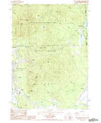
1987 Map of North Conway East
USGS Topo · Published 1987About this map
North Conway and the neighboring village of Kearsarge serve as a focal point for this 1987 survey of the New Hampshire and Maine borderlands. The landscape is defined by the prominent heights of the Green Hills, including Cranmore Mtn with its active Ski Lift and the steep Redstone Ledge. The eastern reach of the White Mountain National Forest dominates the north, where features like Shingle Pond and Hurricane Mtn are set against the remote Province Trail.
Find a feature on this map
58 named features on this map. Tap any name to fly to it.
Don’t see what you’re looking for? This feature index may not catch every label — zoom into the map to look around manually.
Map Details
Editions of this 1987 North Conway East Map
This is the sole edition of this map. No revisions or reprints were ever made.
Other maps of this area

1894 · North Conway
USGS Topo · 1:62,500

1896 · North Conway
USGS Topo · 1:62,500

1909 · Fryeburg
USGS Topo · 1:62,500

1910 · Kezar Falls
USGS Topo · 1:48,000

1911 · Fryeburg
USGS Topo · 1:62,500

1911 · Kezar Falls
USGS Topo · 1:62,500

1930 · Ossipee Lake
USGS Topo · 1:62,500

1941 · Fryeburg
USGS Topo · 1:62,500

1942 · North Conway
USGS Topo · 1:62,500

1945 · North Conway
USGS Topo · 1:62,500