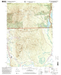
1995 Map of North Conway East
USGS Topo · Published 2000About this map
The Saco River and its varied tributaries define the terrain of this White Mountains region as it appeared in the mid-1990s. The village of North Conway serves as a primary hub of development, featuring the Conway Scenic Railway and several ski lifts on the slopes of Cranmore Mountain. The landscape transitions from the residential and commercial areas around Redstone and the Mobile Home Park to the protected wildlands of the White Mountain National Forest and Conway State Forest.
Find a feature on this map
49 named features on this map. Tap any name to fly to it.
Don’t see what you’re looking for? This feature index may not catch every label — zoom into the map to look around manually.
Map Details
Editions of this 1995 North Conway East Map
This is the sole edition of this map. No revisions or reprints were ever made.
Other maps of this area

1894 · North Conway
USGS Topo · 1:62,500

1896 · North Conway
USGS Topo · 1:62,500

1909 · Fryeburg
USGS Topo · 1:62,500

1910 · Kezar Falls
USGS Topo · 1:48,000

1911 · Fryeburg
USGS Topo · 1:62,500

1911 · Kezar Falls
USGS Topo · 1:62,500

1930 · Ossipee Lake
USGS Topo · 1:62,500

1941 · Fryeburg
USGS Topo · 1:62,500

1942 · North Conway
USGS Topo · 1:62,500

1945 · North Conway
USGS Topo · 1:62,500