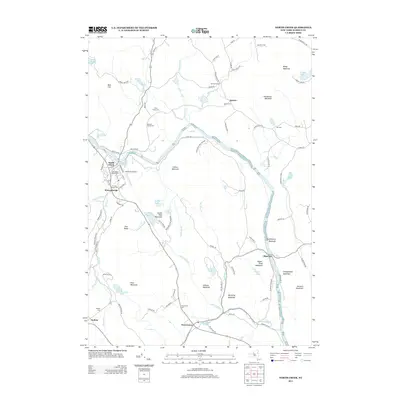
2013 Map of North Creek
USGS Topo · Published 2013About this map
The Hudson River cuts a wide path through this portion of the Adirondack Park Preserve, serving as the primary geographic axis for a series of mountain-shadowed settlements. Along its banks, the village of North Creek stands as a central hub, flanked by the residential pockets of Holcombville and the landing at Riparius. This area is particularly dense with genealogical interest, containing numerous burial sites that reflect the region's heritage, including the N Creek Union Cem, Tyrel Family Cem, and Baroudi Family Cem.
Find a feature on this map
99 named features on this map. Tap any name to fly to it.
Don’t see what you’re looking for? This feature index may not catch every label — zoom into the map to look around manually.
Map Details
Editions of this 2013 North Creek Map
This is the sole edition of this map. No revisions or reprints were ever made.
Other maps of this area

1895 · North Creek
USGS Topo · 1:62,500

1897 · North Creek
USGS Topo · 1:62,500

1897 · Schroon Lake
USGS Topo · 1:62,500

1898 · Newcomb
USGS Topo · 1:62,500

1898 · Thirteenth Lake
USGS Topo · 1:62,500

1901 · Newcomb
USGS Topo · 1:62,500

1950 · Glens Falls
USGS Topo · 1:250,000

1950 · Utica
USGS Topo · 1:250,000

1953 · Schroon Lake
USGS Topo · 1:62,500

1954 · Newcomb
USGS Topo · 1:62,500