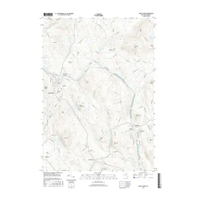
2016 Map of North Creek
USGS Topo · Published 2016About this map
Wevertown and North Creek anchor this survey of the Adirondack foothills, where the Hudson River bends through a landscape of concentrated mountain peaks and small upland basins. The map documents a dense network of family history and community life, preserved in the locations of the Tyrel Family Cem, Baroudi Family Cem, and North Creek Union Cem. In Holcombville and Sodom, the proximity of local landmarks like Bennetts Airport and numerous water bodies, including Antler Lake and Bird Pond, illustrates the region's character as a hub for both permanent residency and recreation. The geography is defined by prominent heights such as Oven Mtn and Collins Mtn, which frame the narrow valleys of Mill Creek and Roaring Brook. These terrain features shaped the placement of local roads like Dillon Hill Rd and Tabernacle Loop, connecting the dispersed settlements of Igerna and Riparius across the undulating terrain.
Find a feature on this map
99 named features on this map. Tap any name to fly to it.
Don’t see what you’re looking for? This feature index may not catch every label — zoom into the map to look around manually.
Map Details
Editions of this 2016 North Creek Map
This is the sole edition of this map. No revisions or reprints were ever made.
Other maps of this area

1895 · North Creek
USGS Topo · 1:62,500

1897 · North Creek
USGS Topo · 1:62,500

1897 · Schroon Lake
USGS Topo · 1:62,500

1898 · Newcomb
USGS Topo · 1:62,500

1898 · Thirteenth Lake
USGS Topo · 1:62,500

1901 · Newcomb
USGS Topo · 1:62,500

1950 · Glens Falls
USGS Topo · 1:250,000

1950 · Utica
USGS Topo · 1:250,000

1953 · Schroon Lake
USGS Topo · 1:62,500

1954 · Newcomb
USGS Topo · 1:62,500