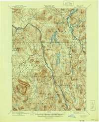
2023 Map of North Creek
USGS Topo · Published 2023About this map
The Hudson River carves a deep valley through this Warren County landscape, anchoring the settlements of North Creek, Riparius, and Wevertown. This contemporary data shows the complex terrain of the Adirondack foothills, where elevations rise sharply from the riverbanks to summits like Huckleberry Mountain and Oven Mountain. The distribution of local landmarks such as Bennetts Airport and the Ski Bowl Connector Trl highlights the area's modern identity as a hub for mountain recreation and aviation.
Find a feature on this map
97 named features on this map. Tap any name to fly to it.
Don’t see what you’re looking for? This feature index may not catch every label — zoom into the map to look around manually.
Map Details
Editions of this 2023 North Creek Map
This is the sole edition of this map. No revisions or reprints were ever made.
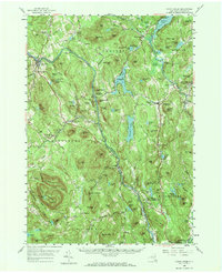
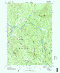
Historical Maps of Igerna Through Time
5 maps found