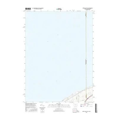
2016 Map of North East OE N
USGS Topo · Published 2016About this map
Lake Erie dominates this coastal survey, where the waters of the Great Lakes meet the northernmost edge of the Appalachian Plateau. The landscape transition is marked by the sharp shoreline where the land rises into the low bluffs of Chautauqua County. A network of local corridors, including Old Lake Rd and Middle Rd, runs parallel to the water, following the natural contours of the lakefront. This area is defined by its position on the interstate border, where the boundary between Pennsylvania and New York meets the line dividing Erie and Chautauqua counties. The map reflects a predominantly rural shoreline characterized by these historical roadway alignments and the proximity to the state line.
Find a feature on this map
8 named features on this map. Tap any name to fly to it.
Don’t see what you’re looking for? This feature index may not catch every label — zoom into the map to look around manually.
Map Details
Editions of this 2016 North East OE N Map
This is the sole edition of this map. No revisions or reprints were ever made.
Other maps of this area

1899 · Westfield
USGS Topo · 1:62,500

1905 · Clymer
USGS Topo · 1:62,500

1913 · North East
USGS Topo · 1:62,500

1915 · North East
USGS Topo · 1:62,500

1939 · Clymer
USGS Topo · 1:62,500

1941 · Clymer
USGS Topo · 1:62,500

1943 · North East
USGS Topo · 1:62,500

1954 · South Ripley
USGS Topo · 1:24,000

1954 · Ripley
USGS Topo · 1:24,000

1960 · Buffalo
USGS Topo · 1:250,000