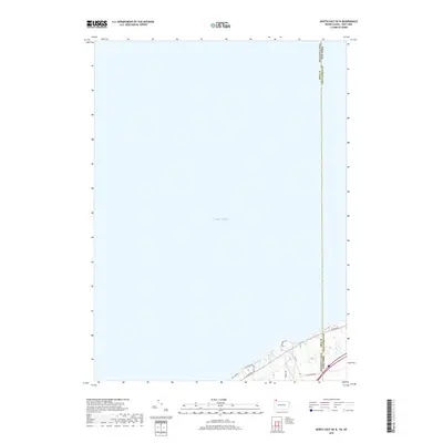
2019 Map of North East OE N
USGS Topo · Published 2019About this map
Lake Erie dominates this coastal survey, where the northwest corner of Chautauqua County meets the Pennsylvania state line. The map captures a narrow but vital strip of the New York shoreline, defined by the mouth of Twentymile Creek and a network of arterial roads that parallel the lake. These routes, including W Lake Rd and Old Lake Rd, trace the historic transportation corridor that has long connected the Great Lakes region. The landscape is marked by the transition from the open waters of the lake to the immediate inland topography, where local connectors like N Hammond Rd and Middle Rd reach toward the shore. This 2019 edition provides a contemporary record of the property boundaries and infrastructure along the Pennsylvania New York border, a significant point of interest for those studying the geographic limits and coastal development of the Ripley area.
Find a feature on this map
13 named features on this map. Tap any name to fly to it.
Don’t see what you’re looking for? This feature index may not catch every label — zoom into the map to look around manually.
Map Details
Editions of this 2019 North East OE N Map
This is the sole edition of this map. No revisions or reprints were ever made.
Other maps of this area

1899 · Westfield
USGS Topo · 1:62,500

1905 · Clymer
USGS Topo · 1:62,500

1913 · North East
USGS Topo · 1:62,500

1915 · North East
USGS Topo · 1:62,500

1939 · Clymer
USGS Topo · 1:62,500

1941 · Clymer
USGS Topo · 1:62,500

1943 · North East
USGS Topo · 1:62,500

1954 · South Ripley
USGS Topo · 1:24,000

1954 · Ripley
USGS Topo · 1:24,000

1960 · Buffalo
USGS Topo · 1:250,000