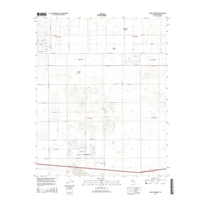
2015 Map of North Edwards
USGS Topo · Published 2015About this map
North Edwards and the southern reaches of California City anchor this 2015 study of the western Mojave Desert. The landscape is defined by an expansive grid of planned residential streets and rural corridors, many of which remain undeveloped, reflecting the unique mid-century urbanization patterns of Kern County. Centered on Peerless Valley, the map shows a network of named thoroughfares such as Sequoia Blvd and Peerless Blvd that stretch across the arid terrain. The industrial and historical character of the region is grounded by features like Clay Mine Rd and the evocative 20 Mule Team Rd to the south. Other local routes, including Dust Devil Ave and Suckow Rd, provide precise navigation through the desert blocks, illustrating the intersection of modern municipal planning with the stark environmental realities of the high desert.
Find a feature on this map
37 named features on this map. Tap any name to fly to it.
Don’t see what you’re looking for? This feature index may not catch every label — zoom into the map to look around manually.
Map Details
Editions of this 2015 North Edwards Map
This is the sole edition of this map. No revisions or reprints were ever made.
Other maps of this area

1915 · Searles Lake
USGS Topo · 1:250,000

1937 · Kramer
USGS Topo · 1:48,000

1937 · Rogers Lake
USGS Topo · 1:48,000

1942 · Kramer
USGS Topo · 1:62,500

1942 · Rogers Lake
USGS Topo · 1:62,500

1943 · Castle Butte
USGS Topo · 1:62,500

1947 · Fluhr
USGS Topo · 1:24,000

1947 · Castle Butte
USGS Topo · 1:50,000

1947 · Rich
USGS Topo · 1:24,000

1947 · Desert Butte
USGS Topo · 1:24,000