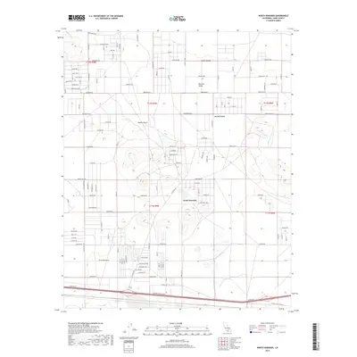
2018 Map of North Edwards
USGS Topo · Published 2018About this map
North Edwards and Aerial Acres anchor this desert landscape within the Mojave Desert of eastern Kern County. The map reveals a distinctive grid-iron settlement pattern typical of mid-century desert subdivisions, where long thoroughfares like Rosewood Blvd and Sequoia Blvd stretch across the arid terrain. To the north, Peerless Valley transition into the higher desert floor, marked by a dense network of local roads such as Tamarack Ave and Dartmouth Ave. To the south, the major transportation corridor is defined by Barstow Rd and the evocatively named Twenty Mule Team Rd, reflecting the region's deep ties to historic mining transit. The layout of these communities, with their numerous residential street names plotted amidst the open desert, provides a detailed look at California's inland development and the planned infrastructure of the western Antelope Valley region.
Find a feature on this map
55 named features on this map. Tap any name to fly to it.
Don’t see what you’re looking for? This feature index may not catch every label — zoom into the map to look around manually.
Map Details
Editions of this 2018 North Edwards Map
This is the sole edition of this map. No revisions or reprints were ever made.
Other maps of this area

1915 · Searles Lake
USGS Topo · 1:250,000

1937 · Kramer
USGS Topo · 1:48,000

1937 · Rogers Lake
USGS Topo · 1:48,000

1942 · Kramer
USGS Topo · 1:62,500

1942 · Rogers Lake
USGS Topo · 1:62,500

1943 · Castle Butte
USGS Topo · 1:62,500

1947 · Fluhr
USGS Topo · 1:24,000

1947 · Castle Butte
USGS Topo · 1:50,000

1947 · Rich
USGS Topo · 1:24,000

1947 · Desert Butte
USGS Topo · 1:24,000