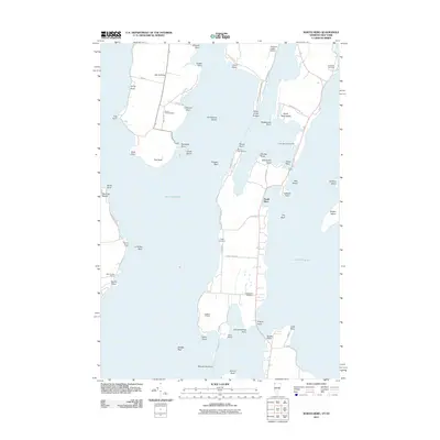
2011 Map of North Hero
USGS Topo · Published 2011About this map
North Hero Island and Isle La Motte dominate this maritime landscape within Lake Champlain, where narrow points and shoals define the navigation of these Vermont and New York waters. The map reveals a community deeply connected to the lake, featuring established landmarks like Camp Abnaki, Ingalls 4-H Camp, and the Carry Bay Campground. On the mainland at Point Au Roche, the Point Au Roche Light stands near Monty Point, while the interior of the islands is dotted with local heritage sites including South End Cemetery and Jerusalem Cemetery. The irregular shoreline is a dense network of family-named features such as Pelots Point, Hazen Point, and Savage Point. This era shows the continued importance of recreation and aviation, with both Mooney Bay Marina and the Northern Lights Airport serving the area.
Find a feature on this map
66 named features on this map. Tap any name to fly to it.
Don’t see what you’re looking for? This feature index may not catch every label — zoom into the map to look around manually.
Map Details
Editions of this 2011 North Hero Map
This is the sole edition of this map. No revisions or reprints were ever made.
Other maps of this area

1894 · Plattsburg
USGS Topo · 1:62,500

1895 · Rouse Point
USGS Topo · 1:62,500

1906 · Plattsburg
USGS Topo · 1:62,500

1907 · Rouse Point
USGS Topo · 1:62,500

1913 · Milton
USGS Topo · 1:48,000

1914 · St. Albans
USGS Topo · 1:48,000

1915 · Milton
USGS Topo · 1:62,500

1916 · St. Albans
USGS Topo · 1:62,500

1939 · Rouses Point
USGS Topo · 1:62,500

1939 · Plattsburg
USGS Topo · 1:62,500