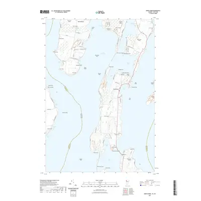
2021 Map of North Hero
USGS Topo · Published 2021About this map
Lake Champlain dominates this study of the islands and peninsulas along the Vermont and New York border, revealing a landscape defined by water and narrow land bridges. The settlement of North Hero occupies the central island, where roads like Station Rd and U S Shore Rd connect local farms to the shoreline. To the west, Isle la Motte shows a concentration of local history markers, including the South End Cem and the aviation facilities at Hawk's Nest Airport. The complex hydrography of the region is evident in the narrow passages of La Motte Passage and Alburg Passage, which separate the islands from the Alburg Tongue. This era shows a mix of agricultural heritage and seasonal activity, with several small cemeteries like Hyde Cem and Jerusalem Cem providing critical data points for genealogical research in this historic border region.
Find a feature on this map
101 named features on this map. Tap any name to fly to it.
Don’t see what you’re looking for? This feature index may not catch every label — zoom into the map to look around manually.
Map Details
Editions of this 2021 North Hero Map
This is the sole edition of this map. No revisions or reprints were ever made.
Other maps of this area

1894 · Plattsburg
USGS Topo · 1:62,500

1895 · Rouse Point
USGS Topo · 1:62,500

1906 · Plattsburg
USGS Topo · 1:62,500

1907 · Rouse Point
USGS Topo · 1:62,500

1913 · Milton
USGS Topo · 1:48,000

1914 · St. Albans
USGS Topo · 1:48,000

1915 · Milton
USGS Topo · 1:62,500

1916 · St. Albans
USGS Topo · 1:62,500

1939 · Rouses Point
USGS Topo · 1:62,500

1939 · Plattsburg
USGS Topo · 1:62,500